Drone photos for New Jersey listings: what agents should know
The FAA rules behind real estate drone work, the airspace that affects New Jersey listings, and when aerials are worth adding.
Real Estate2 min read
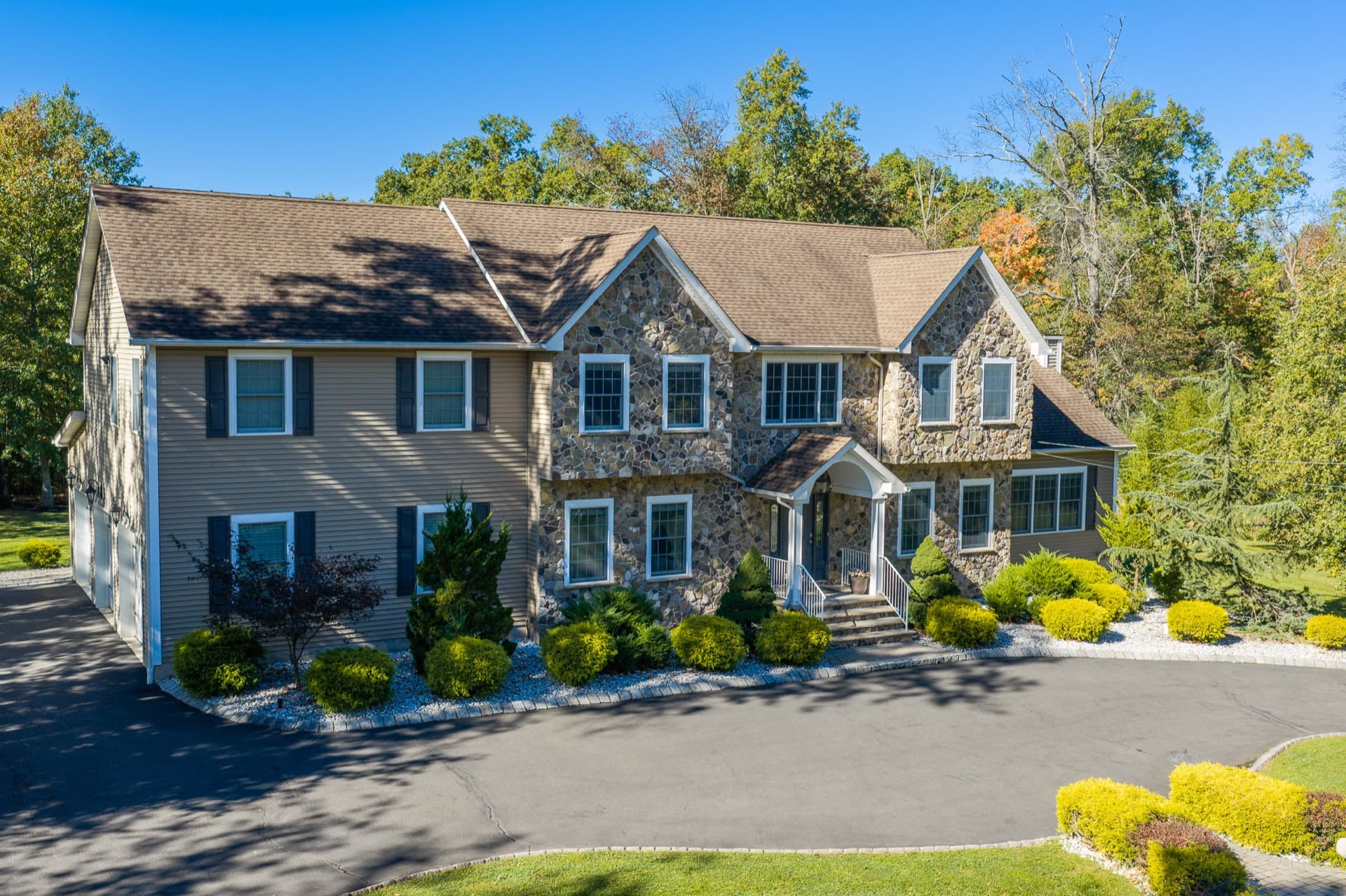
Aerial photos show what ground photos can't: the size and shape of the lot, the pool and the yard, and where the home sits in its neighborhood. They are also the part of a listing shoot with the most rules attached. Here's what agents should know before booking them.
The pilot needs a license
Flying a drone for any business purpose, including real estate marketing, falls under the FAA's Part 107 rules, and the pilot has to hold an FAA Remote Pilot Certificate. A hobbyist flying for free doesn't change that: the photos are for a commercial listing, so the flight is commercial.
It's worth asking whoever shoots your listings whether their pilot is certified. An uncertified flight puts the risk on the shoot, and the listing it was for.
Airspace matters in New Jersey
Much of northern and central New Jersey sits close to airports, from Newark to smaller fields like Morristown and Essex County. Near them, the airspace is controlled, and a drone flight needs an FAA authorization before it can happen.
- Often it's quick. In many places, an authorization can be requested through the FAA's automated system and comes back almost immediately, up to a set altitude.
- Sometimes it isn't. Some addresses need a manual request that can take much longer, or aren't approved at all.
- Temporary restrictions happen. The FAA can close airspace for a while, for example around major events or official visits, and a flight has to wait.
The practical upshot: book drone work early, and expect your photographer to check the address before the shoot, not on the day.
Other limits on the day
- Altitude. Drones generally fly at or below 400 feet, which is plenty for a listing.
- Weather. Strong wind, rain and low cloud ground a flight. Aerials can usually be moved to another day if the interiors go ahead.
- People. The rules limit flying over people who aren't part of the shoot, so busy streets and crowds shape where the drone can go.
- Takeoff spots. Some parks and towns restrict where a drone can take off and land, so the property itself is usually the launch point.
When aerials are worth it
- Larger lots and acreage, where the land is a big part of the value.
- Pools, gardens and outdoor living that are hard to take in from the ground.
- Location as a selling point: close to a downtown, a train station, a park or water.
- Land listings, where there's no house to photograph. See how to market a land listing.
They add less to a condo, or a home on a small lot surrounded by close neighbors, where an aerial mostly shows rooftops. For those, put the budget into interiors, a 3D tour or video.
A note on property lines
Lines drawn on an aerial to show the lot are popular, and useful, but they're an illustration, not a survey. Label them as approximate, and point buyers to the survey for exact boundaries.
We fly under an FAA Part 107 remote pilot certificate and check the airspace for every address before the shoot. Add drone photos, or drone photos and video, on the booking page.
AdReach Studios
A New Jersey studio that photographs, films and edits listings for agents and brokers.